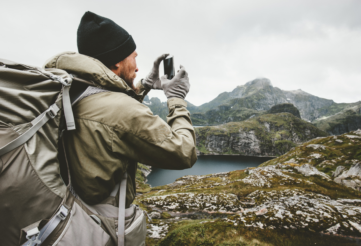
One of the best parts about going hiking is disconnecting from technology and being surrounded by nature. However, we do admit that nowadays, technology can be helpful for hiking.
We particularly enjoy hiking apps for navigation, weather forecasting, and identifying plants and animals. So, this article is for those who, like us, blend tech into their outdoorsy lifestyles.
We’ll highlight 10 of the best hiking apps from three different categories – navigation, weather forecasting, and plant and animal identification.
We’ll discuss their main features, costs, and share helpful information on downloading them yourself. And if you stick around to the end, we’ll introduce a super cool app for all you U.S. National Park fanatics!
List of TOP 10 Popular Hiking Apps for 2026
- NPS App – Official U.S. National Parks guide
- AllTrails – Trail maps with reviews & photos, new app functionality added
- Gaia GPS – Detailed navigation with offline maps
- Komoot – Routes for hiking, biking & backpacking
- Outdoor Active – Navigation plus travel guide features
- Far Out – Thru-hike maps with town waypoints
- Wunderground – Hyper-local weather forecasts worldwide
- AccuWeather – Minute-by-minute weather & radar
- PictureThis – Plant identification with care tips
- iNaturalist – Identify species with community science
Navigation Apps
Hikes are the best when you don’t get lost, right? In this category, we’ll introduce five applications that you can use for trip planning before the hike and navigation while you’re out in the backcountry.
All Trails
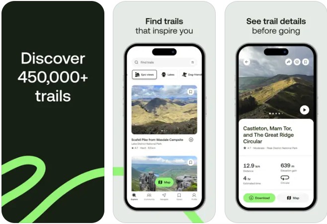

All Trails is the starting point to every great hike. What makes All Trails unique is its gigantic database of trail maps (450,000 trails around the world by location), all equipped with reviews and photos from other hikers. It’s great for trip planning and getting advice so you can be as prepared as possible.
- Available plans: Costs vary, depending on your plan– Base, Plus, or Peak
- Base: free
- Plus: $35.99/year
- Peak: $79.99/year
- Platform: Apple and Android
- Main features: Custom trip planning, 3D options, heat mapping, community-sourced reviews, and photos.
- Offline capability: Yes (for AllTrails+ and Peak members). Unplug completely or plan ahead and take a printed map. Explore without signal with map downloads for trails, parks, and entire areas.
Gaia GPS

Gaia GPS is fantastic for navigation. It features over 300 different maps (NatGeo Trails Illustrated, Private Lands), including numerous map layers for added detail. You can plan a trip, measure point-to-point distances, and generate elevation profiles. You can even get weather, wildfire, and avalanche forecasts as well as discover ski slopes and cross country skiing trails. If you want to navigate the backcountry like a pro, there really is no better tool than Gaia GPS.
- Available plans:
- Free
- Premium: $44.92 for the first year, plus applicable taxes
- Outside+: $67.49 for the first year, plus applicable taxes
- Platform: Apple and Android
- Main features: impressive map database, offline navigation, tracking, recording, and real-time statistics. Unlimited digital access to Outside Network’s 15 iconic brands including Outside, Backpacker and National Park Trips and more.
- Offline capability: Yes, for Premium and Outside+ plans. Activity tracker and route planner make trekking, hiking, and backpacking offroad trails simple. GPS coordinates help explore while creating routes and tracking progress.
Kamoot
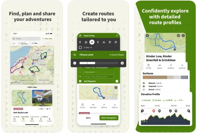

One of my favorite hiking apps as it lets you contribute photos, tips, and highlights to the community and show you’re a local Expert. Kamoot will help you get to your highest peak and deepest backcountry dirt track. What makes Kamoot so special is that it’s not just for hiking. Kamoot is also really helpful for route planning and navigation for mountain biking, road cycling, and multi-day backpacking. It can be fully integrated into any device, including smart watches, GPS computers, and even e-bikes.
- Available plans:
- Free
- Premium
- One-time purchases– regional bundles or world map pack
- Platform: Apple and Android
- Main features: ready-built routes, route planning, including multi-day trips, and turn-by-turn navigation. You can also differentiate hiking paths, MTB singletracks or paved roads, terrain and land cover at a glance.
- Offline capability: Yes
Outdoor Active
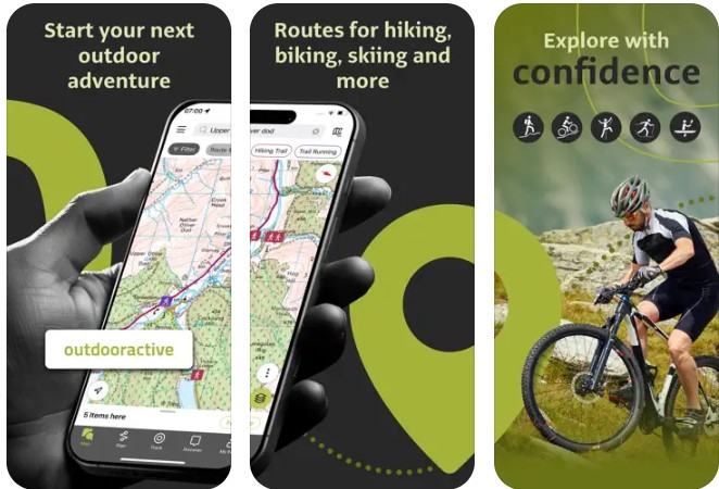

Outdoor Active is more than just a navigation tool. It’s a travel guide and community of like-minded adventurers. Outdoor Active has an impressive database of maps from 25 countries, routes, places to visit, and overnight accommodations. It’s essentially a navigation tool and travel guide for outdoor and adventure tourism. You can find here amazing well known and hidden hiking paths, trekking trails, mountain biking routes, trail running paths, ski touring routes, and more.
Available plans:
- Free
- Pro: $35.39 per year
- Pro+: $70.79 per year
Main features: trail networks for multiple activities, satellite imagery, steepness profiles, and Buddy Beacon live location, 3D mapping, and accurate weather forecasts & meteorological info
Offline capability: Yes, for Pro and Pro+ plans. Save individual plans or entire areas offline for reliable navigation when you don’t have a phone signal.
Countries covered: Official topo maps in 25 countries, including:
Ordnance Survey (Landranger & Explorer) in the United Kingdom, New Zealand Land Information in NZ, USGS in the USA, BKG in Germany, BEV in Austria, Swisstopo in Switzerland, IGN in France, PDOK in the Netherlands, Kartverket in Norway, Lantmäteriet in Sweden, Finland National Land Survey in Finland, Harvey Maps in the UK, the official Alpine Club maps for climbing in the Alps.
Far Out
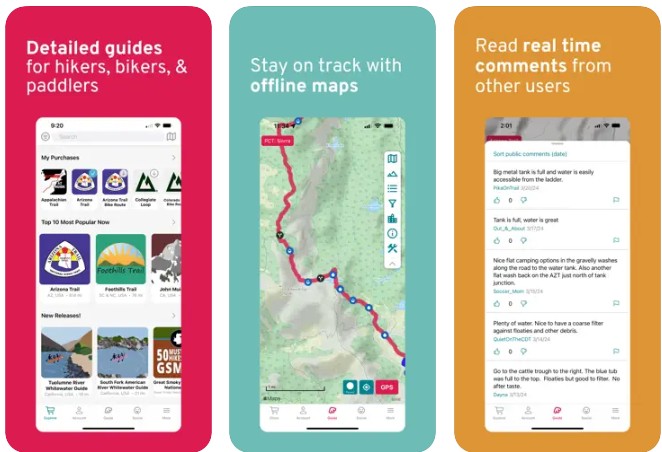

Far Out is the best navigation tool for long-distance trails, including hiking, thru-hiking, and cycling. All of the routes are meticulously updated. The tracks of the different routes include vital waypoints, alternate routes, and side trails. The app even includes detailed town guides for when you have to leave the trail for civilization.
It has offline capabilities, including all the maps, elevation profiles, and waypoints. The community feature also allows you to update loved ones with your location and learn from other hikers on the trail.
- Available plans:
- The app is free to download, but the maps are one-time purchases and vary in price based on trail length.
- Far Out Unlimited– monthly, season pass, or annual
- Platform: Apple and Android
- Main features: tracks of primary trails, including side trails and alternate routes, along with key waypoints. Community feature to stay in touch with family and other hikers. Updated 200 hiking, biking, whitewater rafting and paddling navigational guides around the world.
- Offline capability: Yes, after initial setup of the app, all of your trail guides work offline.
- Countries covered: FarOut hiking app includes guides in popular long-distance hiking, biking, rafting, and paddling routes worldwide, including the United States, Australia, Canada, the UK, Europe, New Zealand, the Middle East, South America, and Central America.
Weather Forecasting Apps
Being adequately prepared for a hike hinges on the weather. The weather dictates when you go, what you wear, and what equipment you bring. In this section, we’ll share two of our favorite weather forecasting apps you can use to guide your decision-making for hiking.
Wunderground
Weather Underground, also known as Wunderground, is a fantastic weather app. It’s especially good at providing hyper-local weather data, no matter where you are in the world. Wunderground is so powerful because it can be pinpointed to any microclimate, thanks to the data points it collects from over 250,000 personal weather stations across the planet. In addition to the app, Wunderground has a web-based platform for trip planning while you are on your computer.
- Cost: free
- Platform: Apple and Android
- Main features: interactive map with weather radar and high-resolution satellite imagery, and weather alerts for severe weather
- Offline capability: No, Wunderground is not designed to be utilized offline
AccuWeather
AccuWeather forecasts every longitude and latitude on the globe with impressive accuracy. With the AccuWeather app, you can get minute-by-minute precipitation updates, and AccuWeather’s Real Feel– the most accurate representation of what the temperature actually feels like. Their real-time radar is super helpful for tracking storms, and you can even get hyper-local air quality forecasts, including allergen forecasts, so you know which days it’s okay to be adventuring outside.
- Cost: costs vary, depending on your plan
- Platform: Apple and Android
- Main features: minute-by-minute forecasting, Real Feel temperature, government weather alerts, AccuLumen Brightness Index, hourly forecast graphs, and long-range forecasts
- Offline capability: No, AccuWeather is not designed to be utilized offline
Flora and Fauna Identification Apps
One of our favorite parts of being outside is seeing all the interesting plants and animals, and even sometimes, the creepy crawlies. So in this section, we’ll talk about two helpful apps you can use to identify and learn about the flora and fauna you are observing out in the wild.
PictureThis
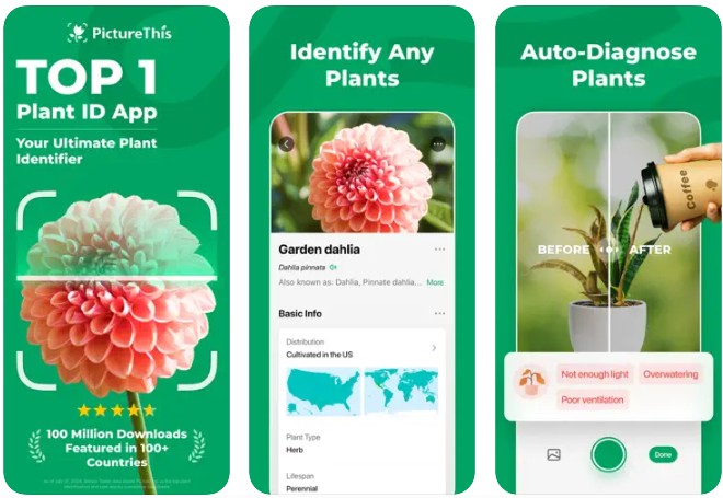

PictureThis is like having an AI botanist in your pocket at all times. With PictureThis, you can instantly identify over 400,000 plant species using your smartphone camera. Their app is perfect for identifying plants you find on the trail or even in your backyard (98% accuracy)! You can also get information on plant disease diagnosis and prevention, and other tips and tricks for your beloved house plants. PictureThis also helps you identify toxic plants, which is especially helpful for pets who love snacking on their surroundings.
- Cost: prices can very
- Free– with limited plant identifications
- Premium– unlimited plant identifications
- Platform: Apple and Android
- Main features: plant identifier, including poisonous plants, plant care guides, watering reminders, and auto-diagnosis and prevention of plant diseases
- Offline capability: No, the identification process requires a network connection. However, the photos you take while offline will automatically be saved in the app and will be identified once you’re back online.
iNaturalist
iNaturalist is one of the most helpful nature apps. With iNaturalist, you can identify the different plants and animals you see around you. In addition, what makes iNaturalist so unique is that it connects you with a community of over 400,000 scientists and naturalists who can help you learn more about nature. Even better, the photos, recordings, and observations you take can become research data to help scientists.
- Cost: free– the platform is a nonprofit supported by donations
- Platform: Apple and Android
- Main features: cloud-based storage of all your observations, crowdsourced identifications, community connection to other naturalists, and data contributions to the sciences and natural resource managers
- Offline capability: Yes, you can make observations on the iNaturalist app without cell reception or wifi. download content from entire parks for offline use
Pro tip: if you have cellphone reception while hiking, the Google Lens function on your Android smartphone also works for identifying insects, plants, and animals you find on the trail.
Bonus App: U.S. National Park Service App

Ask any citizen of the United States where the most beautiful hiking trails are found, and they’ll probably mention the National Parks. Ask any outdoorsy tourist to the U.S. and they’ll probably say the same thing.
If you’re considering visiting a National Park for your next hike, you’ve got to download the U.S. National Park Service (NPS) App. You won’t be disappointed.
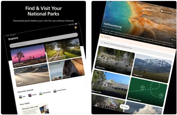
The NPS app is the official app of the U.S. government’s National Park Service. With the NPS App, you can have access to more than 400 national parks at your fingertips. After you’ve downloaded the app, you can search through the database to find helpful maps, info for popular destinations, self-guided tours, and amenities information like transportation, food, restrooms, and shopping.
- Cost: free
- Platform: Apple and Android
- Main features: interactive maps, digital tours, accessibility and amenities information, personalized lists of things to do, news, alerts, and important events
- Offline capability: Yes, download content from entire parks for offline use. But don’t forget to get a paper map at the entrance gate for offline use, also (and for a souvenir of your visit).
Okay, there you have it– the 10 best hiking apps for Android and iPhone we like for navigating, weather forecasting, and identifying awesome plants and animals. Now it’s your turn to do some downloads. And remember, even with these apps downloaded, it’s okay to put your phone on airplane mode, bury it inside your backpack, and enjoy your hike, free from technology.
Here are some smartwatches with GPS function made for hiking you may want to explore as well as other fantastic travel apps.


